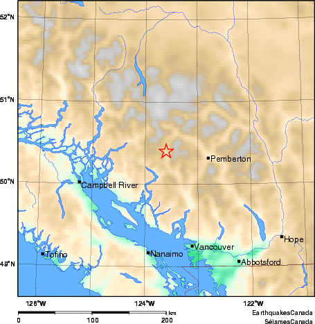
Earthquake Details (2010-08-06)
Friday August 06, 2010
| Local Time: | 03:27:30 PDT |
|---|---|
| Magnitude: | 2.6 ML |
| Latitude: | 50.4 North |
| Longitude: | 123.6 West |
| Depth: | 0.00 km |
| UT Date and Time: |
2010/08/06 10:27:30 UT |
Did you feel it?
Approximate Location of Earthquake: Landslide recorded near Meager Creek, BC with an equivalent magnitude of 2.6. Note: no earthquake is associated with this event.