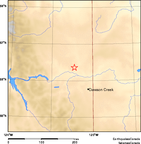
Earthquake Details (2012-10-24)
Wednesday October 24, 2012
| Local Time: | 00:14:03 MST |
|---|---|
| Magnitude: | 2.5 MN |
| Latitude: | 56.36 North |
| Longitude: | 120.9 West |
| Depth: | 10.00 km |
| UT Date and Time: |
2012/10/24 07:14:03 UT |
Did you feel it?
Approximate Location of Earthquake: 24 km NW from Fort St. John, BC. Felt.
Comments:
- NORTHERN BRITISH COLUMBIA SEISMIC ZONE.